Voxelmaps has launched a real-time city digital twin for San Jose that continuously updates as the city changes — a big step beyond traditional static 3D models. Street-level LiDAR sensors feed into a platform that generates photorealistic visuals and lets city teams query their data in plain English: "Where have roadworks changed curb access since last month?" The goal is practical urban operations — infrastructure monitoring, maintenance, and planning — without needing specialist GIS expertise. Voxelmaps plans to expand to 100 U.S. cities over the next two years.

As the energy sector faces rising complexity, climate impacts, and the push for decarbonization, static maps and legacy GIS tools fall short. Voxelmaps’ 4D Spatial Digital Twins offer a dynamic, high-fidelity view of infrastructure — capturing not just space, but time. Built from rich geospatial data and powered by AI, these living models help utilities modernize operations and lay the foundation for an autonomous, net-zero future.

The success of autonomous vehicles hinges on data accuracy and efficiency. Learn how Voxelmaps' advanced mapping solutions help mitigate risk and enable safer, smarter autonomous vehicle development.

At DISTRIBUTECH 2025, Voxelmaps, in partnership with nfoldROI, demonstrated groundbreaking advancements in Digital Twin technology. Featuring the SYMBO DUO Mobile Mapping System, we showcased how 4D Digital Twins can enhance asset maintenance, risk mitigation, and infrastructure planning for utilities.

Accurate geospatial data is key to efficient urban planning and infrastructure development. At Voxelmaps, we provide high-resolution 3D mapping, LiDAR imaging, and seamless GIS integration to optimize planning, reduce costs, and streamline project execution. Discover how precise mapping solutions can drive your project’s success.

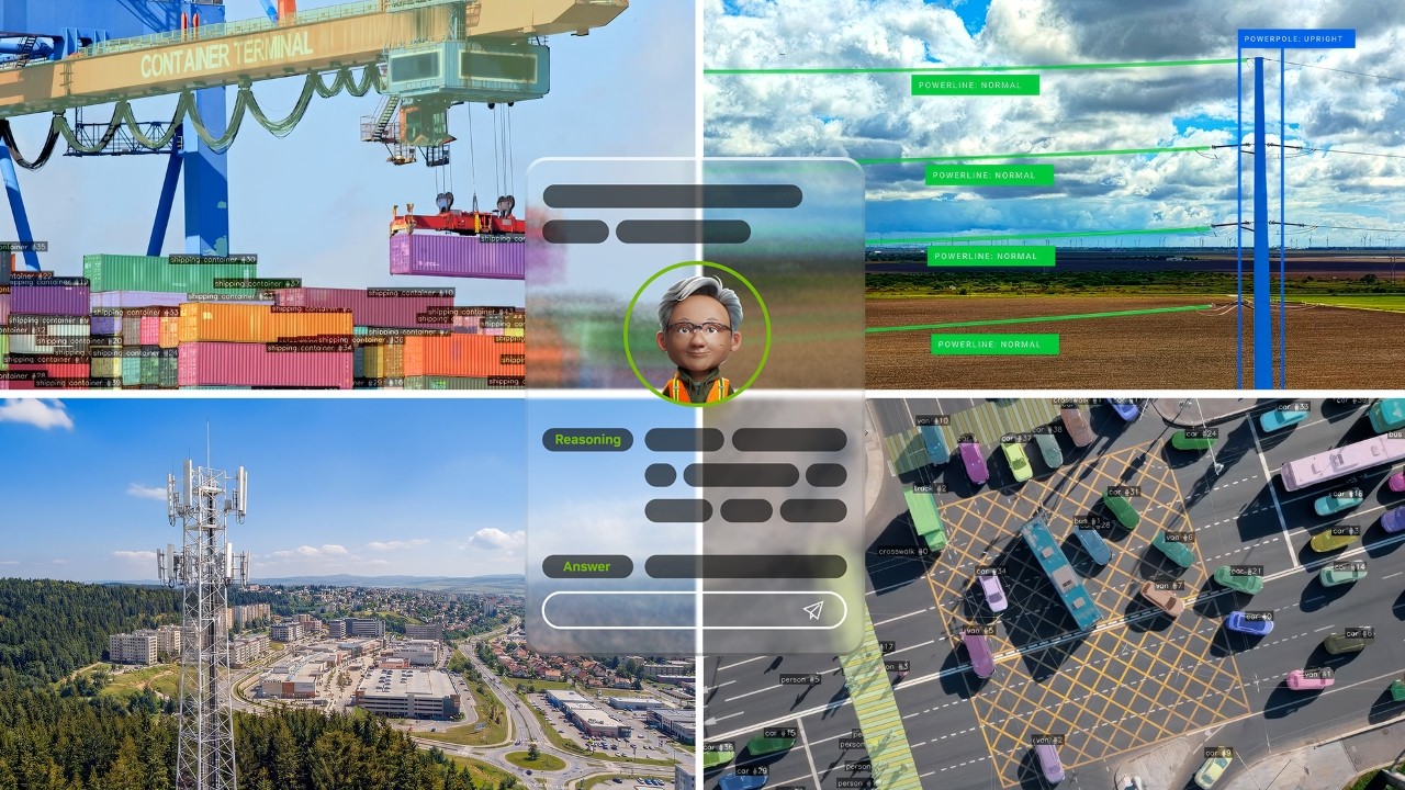
High-precision mapping data is crucial for autonomous driving. Voxelmaps leverages advanced technologies like LiDAR and sensor fusion to provide detailed, real-time localization for self-driving vehicles. Our mapping solutions enhance navigation, safety, and regulatory compliance, empowering OEMs and developers to create smarter, safer autonomous systems. Learn how Voxelmaps’ global data collection and HD maps support AI training and decision-making for the future of autonomous vehicles.

Voxelmaps enhances logistics management for large-scale data collection projects, ensuring that personnel, and equipment are efficiently deployed. Explore how Voxelmaps maximize productivity across global project areas. Seamlessly integrating HD mapping technology, Voxelmaps provides accurate, up-to-date insights for urban planning and infrastructure projects. These logistics solutions reduce delays, cut costs, and allow organizations to focus on project quality and outcomes, from data collection to decision-making.

Explore how comprehensive data sets enhance AI accuracy and scalability. Learn about innovations in 3D mapping, behavioral insights, and real-world audio that improve AI applications in industries like telecommunications, utilities, and smart cities. Discover how Voxelmaps helps businesses build smarter, adaptable AI models.

The evolution of autonomous vehicles (AVs) relies heavily on advanced AI algorithms and data solutions. In our latest blog, we delve into how Voxelmaps supports this technological progress through cutting-edge data solutions.

Un gran ejemplo de datos 3D son los mapas que vemos producidos por Google Maps. Este tipo de datos es una herramienta de visualización brillante, es agradable de ver y amigable para los humanos pero cuando realmente los miras, no hay una gran cantidad de información ahí.