In today’s evolving infrastructure landscape, precise mapping data is essential for efficient urban planning and successful project execution. Those overseeing large-scale initiatives must navigate complex logistics, regulatory compliance, and technology adoption while ensuring accuracy and scalability. At Voxelmaps, we provide advanced geospatial solutions tailored for projects that demand optimized planning, resource allocation, and long-term growth.
The Critical Role of Accurate Mapping Data in Infrastructure Projects
Extensive projects require meticulous planning and coordination. Inaccurate or outdated mapping can lead to costly mistakes, delays, and inefficiencies that impact budgets and schedules. High-accuracy data supports:
- Optimized Urban Planning: Reliable information enhances decision-making, allowing for development that aligns with sustainability goals and future growth.
- Efficient Project Logistics: Comprehensive mapping reduces uncertainties in site conditions, facilitating smoother execution and resource management.
- Regulatory Compliance: Initiatives must adhere to stringent government regulations, requiring precise geospatial data to streamline approvals and reporting.
- Advanced Technology Integration: High-resolution 3D models and HD mapping ensure seamless adoption of cutting-edge planning tools and GIS platforms
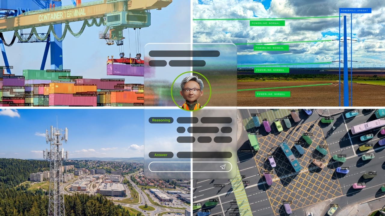
How Voxelmaps Supports Infrastructure Development
Voxelmaps offers scalable, high-fidelity geospatial solutions designed to meet the needs of those overseeing complex infrastructure projects. Our approach includes:
1. High-Resolution 3D Mapping & LiDAR Imaging We leverage LiDAR, AI-driven feature extraction, and high-resolution imagery to generate precise 3D models of urban environments. These datasets enable informed decision-making for intricate development projects.
2. Comprehensive Data Collection & Processing Voxelmaps provides end-to-end geospatial solutions, ensuring accurate, real-time acquisition. AI-driven processing enhances efficiency, delivering reliable intelligence for strategic planning.
3. Scalable Mapping Solutions for Large-Scale Projects Whether managing a nationwide transportation expansion or a smart city initiative, our solutions provide ongoing data updates for improved outcomes.
4. Seamless GIS & CAD Integration Our geospatial data integrates effortlessly with existing GIS, CAD, and fleet management systems, enabling teams to streamline workflows and maximize efficiency.
5. Reducing Costs and Enhancing Project Success By minimizing inconsistencies and reducing rework, Voxelmaps supports project leaders in achieving faster completion, optimized budgets, and improved scalability.
Why Voxelmaps?
Voxelmaps delivers the precision, reliability, and comprehensive geospatial data needed for complex infrastructure initiatives. Our commitment to innovation ensures seamless integration of mapping solutions into urban development, enabling teams to plan with confidence.
As projects grow in complexity, accurate geospatial solutions are critical for staying ahead. Contact Voxelmaps today to discover how our advanced technology can transform your next initiative.